Colorado’s history isn’t one story. It’s many — layered, contested, and still unfolding beneath our feet.
In Colorado’s 150th year of statehood, TERRITORIES offers a composite view of history: not a single narrative through line, but stories from many perspectives.
Our histories draw boundaries, assert ownership, and express the cultural values and ambitions of those who wrote them. Histories illuminate truths and obscure them in equal measure; they often contradict each other. But every account of Colorado’s past reveals a basic human desire to claim one’s relationship to the earth.
Taken together, these stories reveal a common humanity and sense of belonging; they allow us to see ourselves in perspectives far different than our own; they put us more closely in touch with a landscape we already loved, and thought we knew.
TERRITORIES explores one of America’s most iconic regions through the hidden histories embedded in the landscape — surprising, sometimes unsettling, always illuminating.
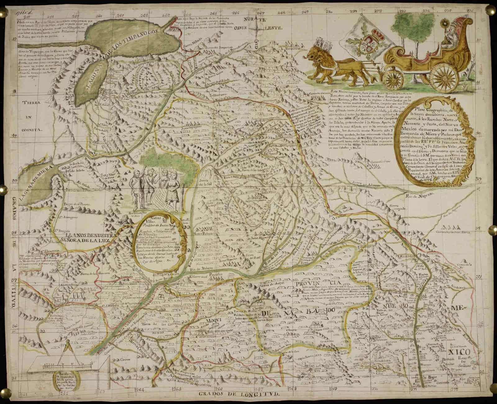
The project takes its name from the speculative, colonial language of the 19th century, when the United States first staked its claim to these lands. But its deeper inspiration reaches back further — to a single remarkable map.
In 1776, Spanish cartographer Bernardo de Miera y Pacheco set out with the Dominguez-Escalante expedition, among the first Europeans to explore this region. The map he made is a document full of contradictions: on paper, the land belonged to the Spanish crown; in reality, it was home to Native peoples who had known it for centuries.
Miera’s map is more than a record of geography. It’s an act of imagination — part colonial arrogance, part evangelical mission, but full of genuine wonder and interest in unfamiliar people and cultures. It’s one man trying to make sense of an extraordinary journey through an unknown world.
TERRITORIES takes inspiration from Miera’s beautiful, flawed, deeply-human attempt to depict this land and the people who have called it home.